-
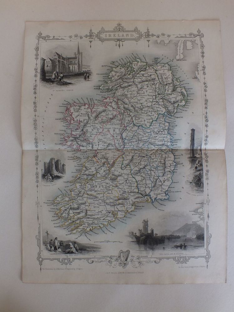
Illustrated Map Of Ireland, J & F Tallis, London, Edinburgh & Dublin, 19th
-
Illustrated Map Of Ireland, J & F Tallis, London, Edinburgh & Dublin, 19th
-
Illustrated Map Of Ireland, J & F Tallis, London, Edinburgh & Dublin, 19th
-
Illustrated Map Of Ireland, J & F Tallis, London, Edinburgh & Dublin, 19th
-
Illustrated Map Of Ireland, J & F Tallis, London, Edinburgh & Dublin, 19th
-
Illustrated Map Of Ireland, J & F Tallis, London, Edinburgh & Dublin, 19th
-
Illustrated Map Of Ireland, J & F Tallis, London, Edinburgh & Dublin, 19th
-
Illustrated Map Of Ireland, J & F Tallis, London, Edinburgh & Dublin, 19th
-
Illustrated Map Of Ireland-J & F Tallis, London, Edinburgh & Dublin-19th Century
- Antique map print originally from old disbound volume of John Tallis Illustrated Atlas (London & New York: John Tallis & Co, c.1851). Illustrated views are of St. Patrick's Cathedral, Dublin; Limerick Castle; the Round Tower, Wicklow; the Holy Well.....
-
£125.00